Large Blocks are Bad
Small blocks encourage walking. Consider this house.
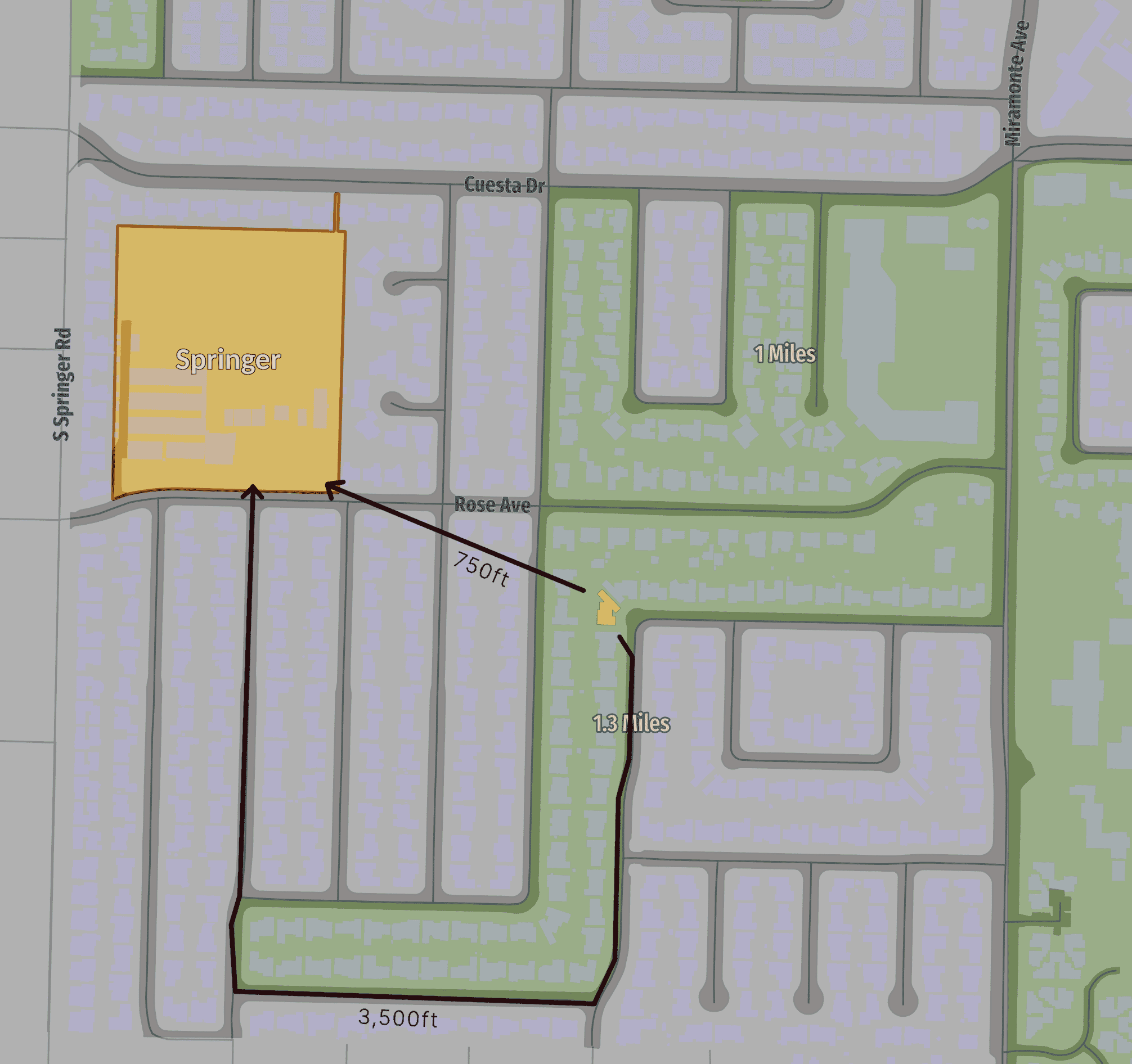
It is very close to the neighborhood school, but the block size and shape makes walking to school 5x the distance.
Blocks and Grids
Mountain View, like most cities, has a grid of small blocks around the downtown. But, starting in the 50s grids and small blocks went out of favor. Newer areas have large blocks and irregular streets.
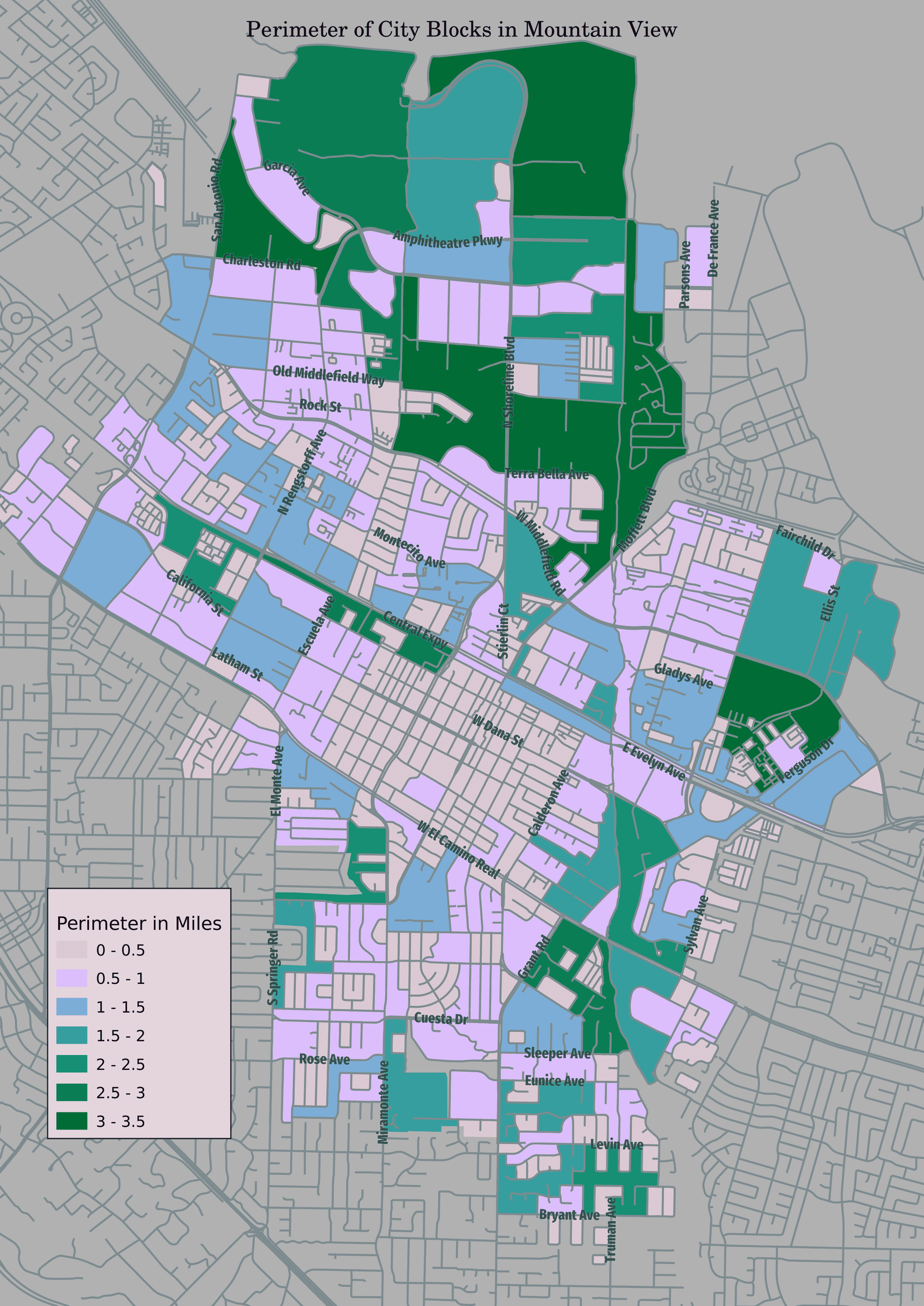
Large blocks are built for two reasons.
- “Suburban” style development uses large blocks and curves to discourage through traffic.
- Large developments - such as townhouses, apartment, or office complexes - can take up more space than a city block. These developments may have an internal network of private streets, but these do not show up on the map above.
Since the “New Urbanists” in the 90s, traditional neighborhood development is back in favor. There are many reasons to favor the small block “traditional” pattern. I will focus on walkability here. Is is very easy to see the benefits for pedestrians.
Small Blocks
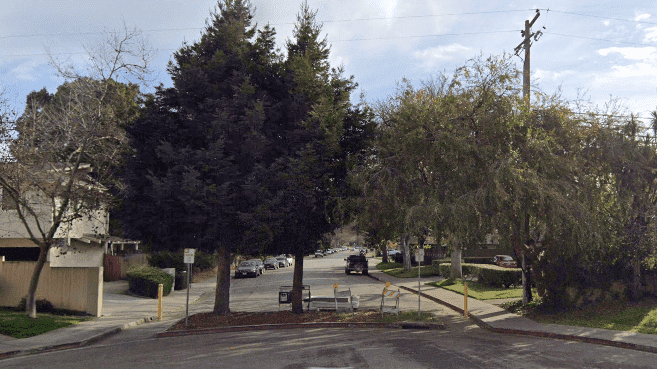
As someone who used to live on Latham, I am very aware of the problem of through traffic. A fix for these areas would be to limit or eliminate through traffic.
Lots of options, such as traffic calming or slow streets. My favorite is to just put up a barrier. You keep the walkability of a small city block, and 100% guarantee no through traffic.
Large Blocks
For existing large blocks the solution is paseos - create pedestrian throughways and cut up the blocks.
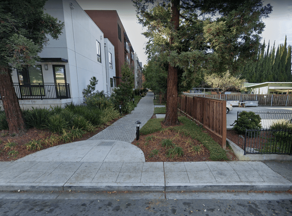
The city has been actively working to increase the number of paseos and paths. Mostly this has been achieved by asking for them when properties get redeveloped. That is how we got the paseo above.
Another way the city is trying to reduce block size is with it’s precise plans. The East Whisman plan has a network of pedestrian and bicycle paths.
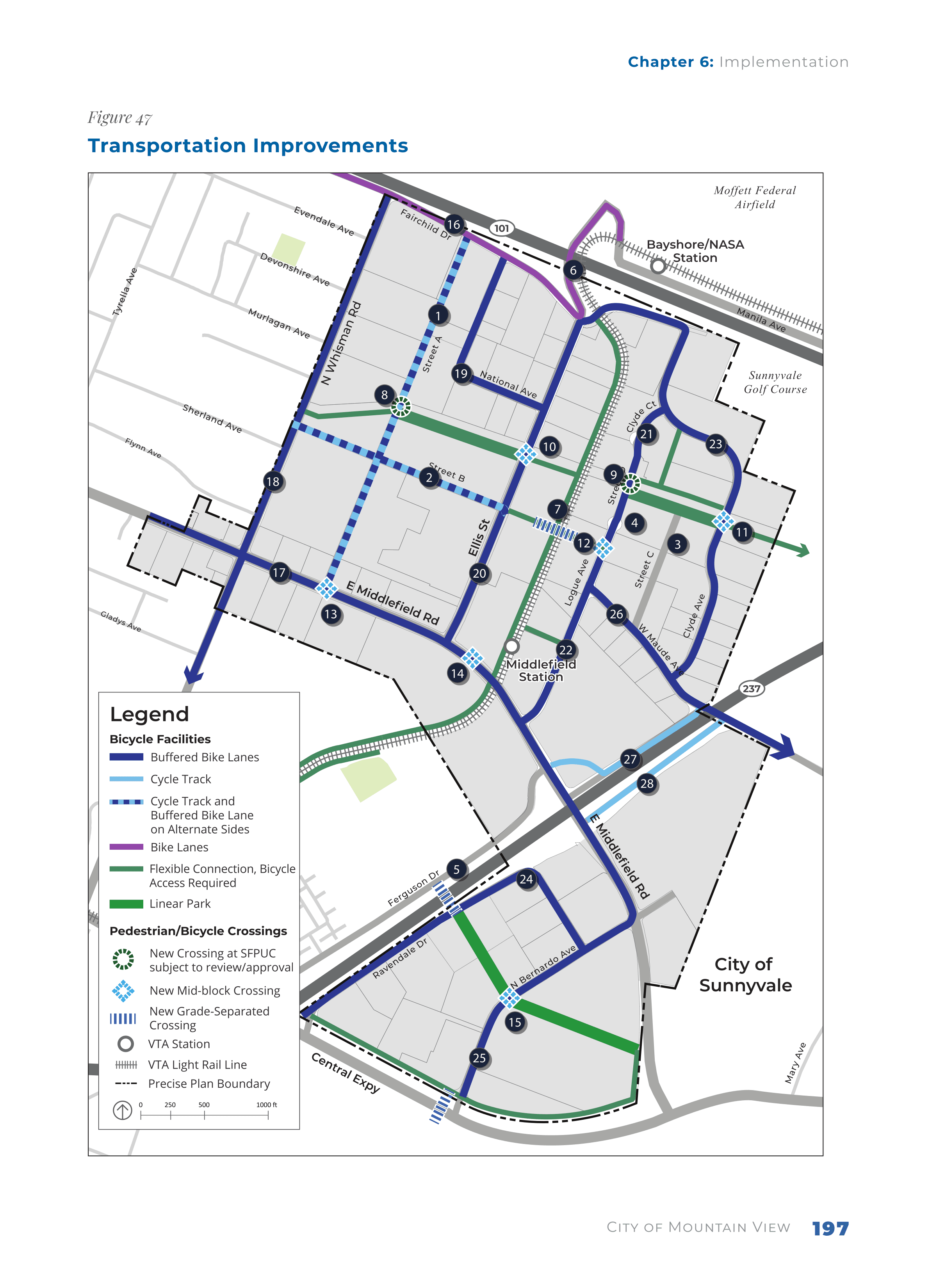
Any new development in the area needs to adhere to the plan. As the area redevelops, the walkability will improve.
A New Plan
This year, the city plans to work on its active transportation plan. I am hoping to see something like the pedestrian path plan in East Whisman, to cut up large blocks in other areas. What streets need to be cured of through traffic? Which areas are most in need of new pedestrian paths? Good input from people who live in different neighborhoods will be valuable.